


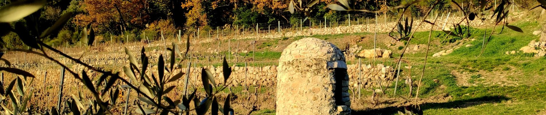
Boucle Ripelle - Mont Combes - Tourris - Ripelle

affinetataille
User GUIDE
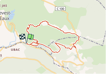

Length
9.9 km

Max alt
413 m

Uphill gradient
353 m
Km-Effort
14.6 km

Min alt
95 m

Downhill gradient
351 m
Boucle
Yes
Creation date :
2020-12-13 12:59:02.797
Updated on :
2020-12-13 20:06:20.052
3h25
Difficulty : Medium

FREE GPS app for hiking
 SityTrail
IGN / Geographical institutes
SityTrail Plus
The world is yours!
About
Trail Walking of 9.9 km to be discovered at Provence-Alpes-Côte d'Azur, Var, Le Revest-les-Eaux. This trail is proposed by affinetataille.
Photos


Positioning
Country:
France
Region :
Provence-Alpes-Côte d'Azur
Department/Province :
Var
Municipality :
Le Revest-les-Eaux
Location:
Unknown
Start:(Dec)
Start:(UTM)
739051 ; 4783329 (31T) N.
Comments